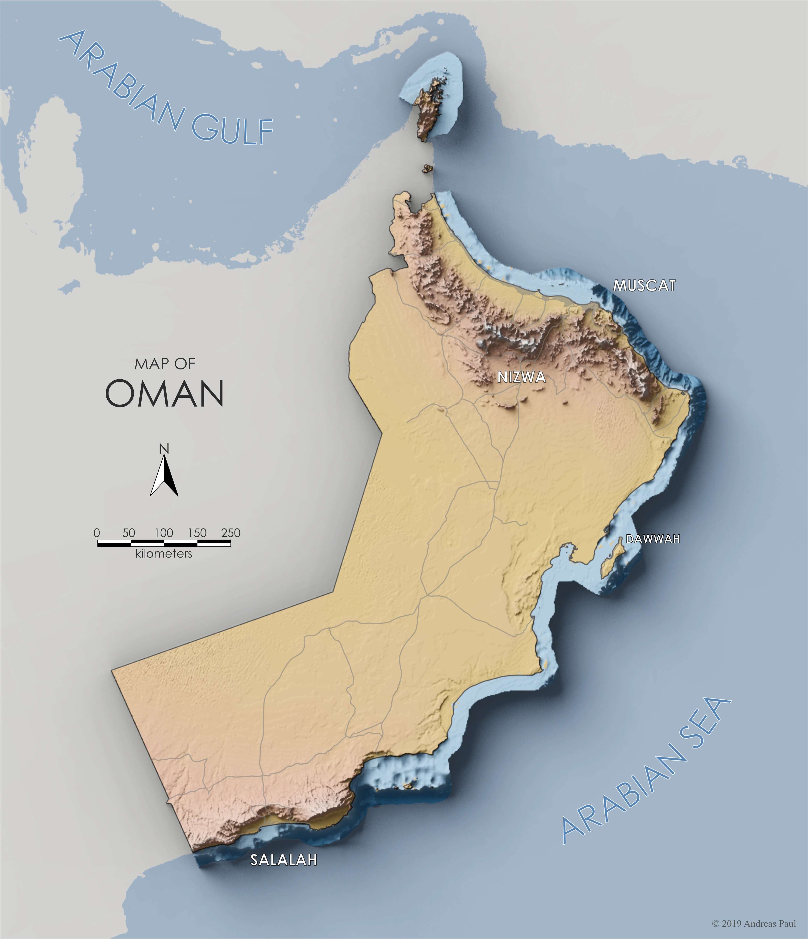
This map shows the country of Oman and some of the features that make it such a unique and wonderful place to be ...
Far to the north, there is Musandam, the Norway of the Middle East. A place of high mountain ranges with oases, beautiful views, outcrops rich with marine fossils, and fjords with dolphins and coral reefs.
To the south of the capital Muscat, in the area surrounding Nizwa, many beautiful mountain ranges can be climbed, Wadis can be waded in, and rock formations filled with water invite visitors to take a short dive.
Further to the south comes the savannah, with vast plains on which small withered trees fight for survival. But the majority of Oman is covered by sand, reaching from West to East, right up to the coast.
Finally, far to the south is Salalah, something of a special place: situated under the influence of the Indian Monsoon, Salalah is rather green for its location, and some days of the year it looks like the Shire, with hills covered in green grass, flowers and lush trees.
The map was created with QGIS, Blender3D and Affinity Photo; annotations where added in Affinity Designer. Elevation data comes from the GEBCO 2019 grid. Data for roads and populated places was downloaded from NaturalEarthData.com.