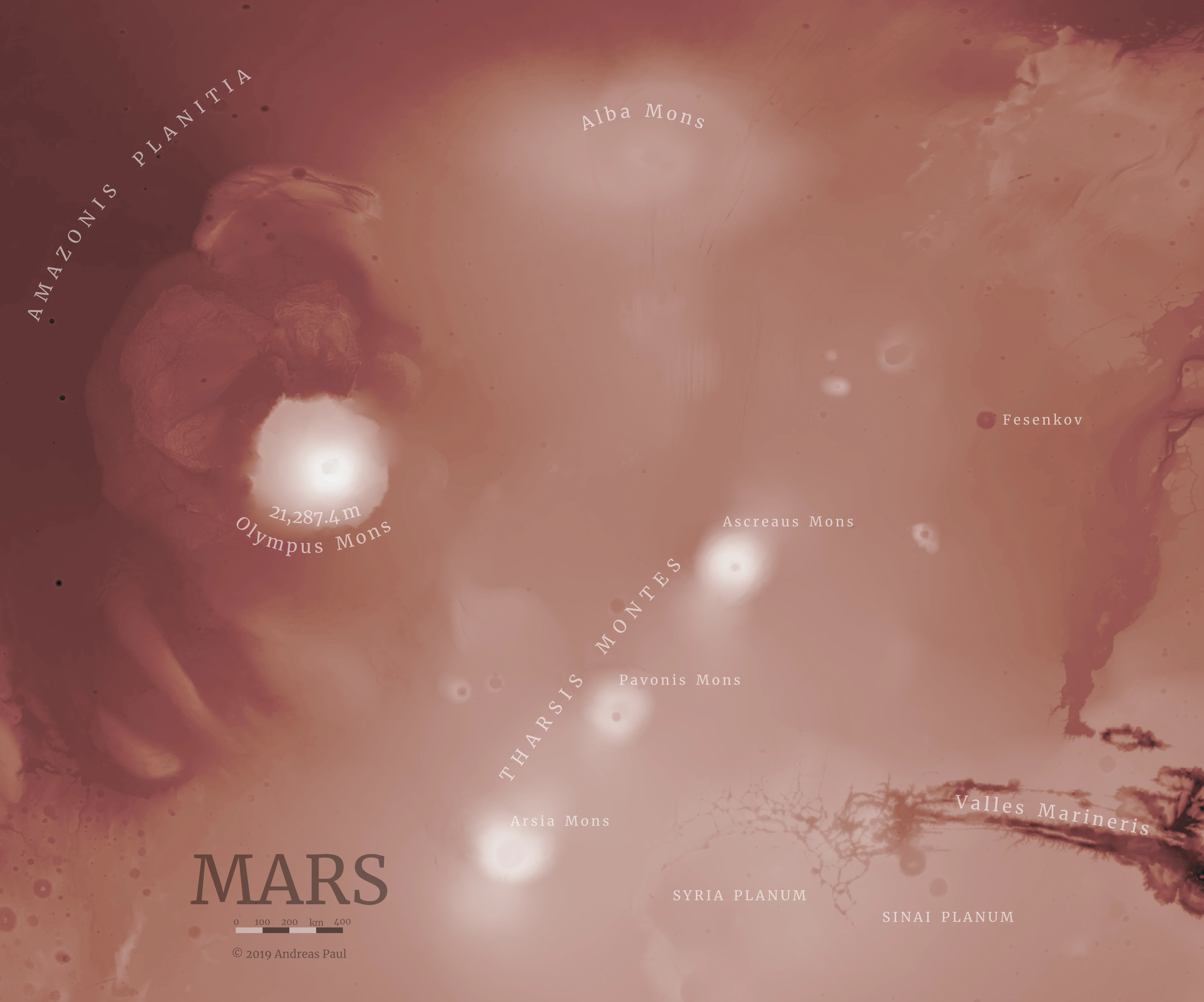
This false-colour map of a region of Mars known as Tharsis shows the highest mountain in the solar system, Olympus Mons, at more than 21 kilometers of elevation base-to-peak. It is accompanied by a chain of strato volcanoes known as Tharsis Montes. To the lower right, the western extension of Valles Marineris is seen.
The map was created with QGIS, and Affinity Photo; annotations where added in Affinity Designer. It uses the MOLA digital elevation model of Mars available here.
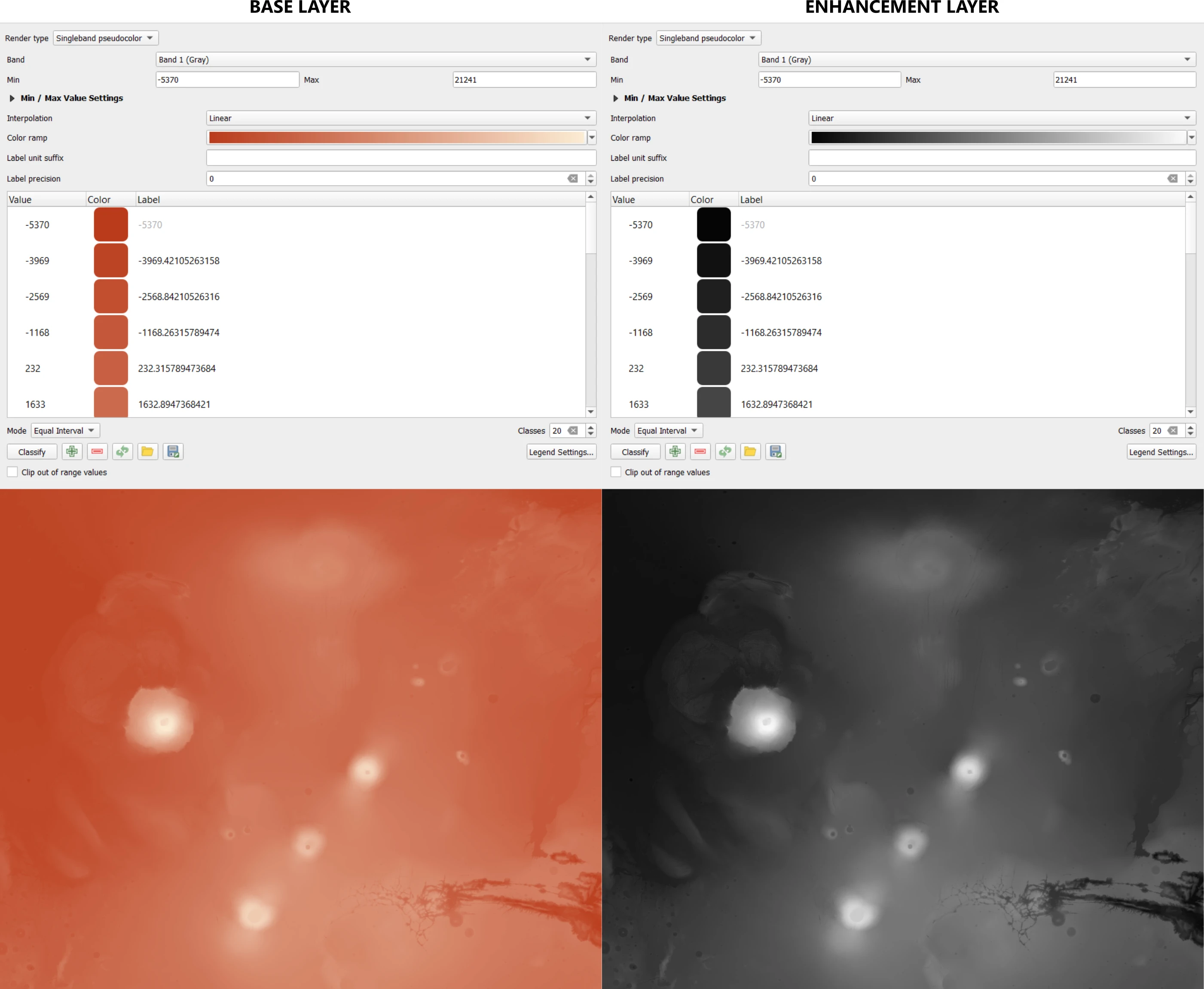
Initially, the raw elevation model was imported into QGIS. A rectangle shape covering the area of interest was created, and subsequently used to crop the DEM. Then, two color styles were applied to the cropped DEM: a base style, which would later serve as the base color, and an enhancement style (grayscale) which would later be used to boost the display of highlights and shadows on the final map (see image below). For each applied style, one image file of the coloured/styled DEM was exported.
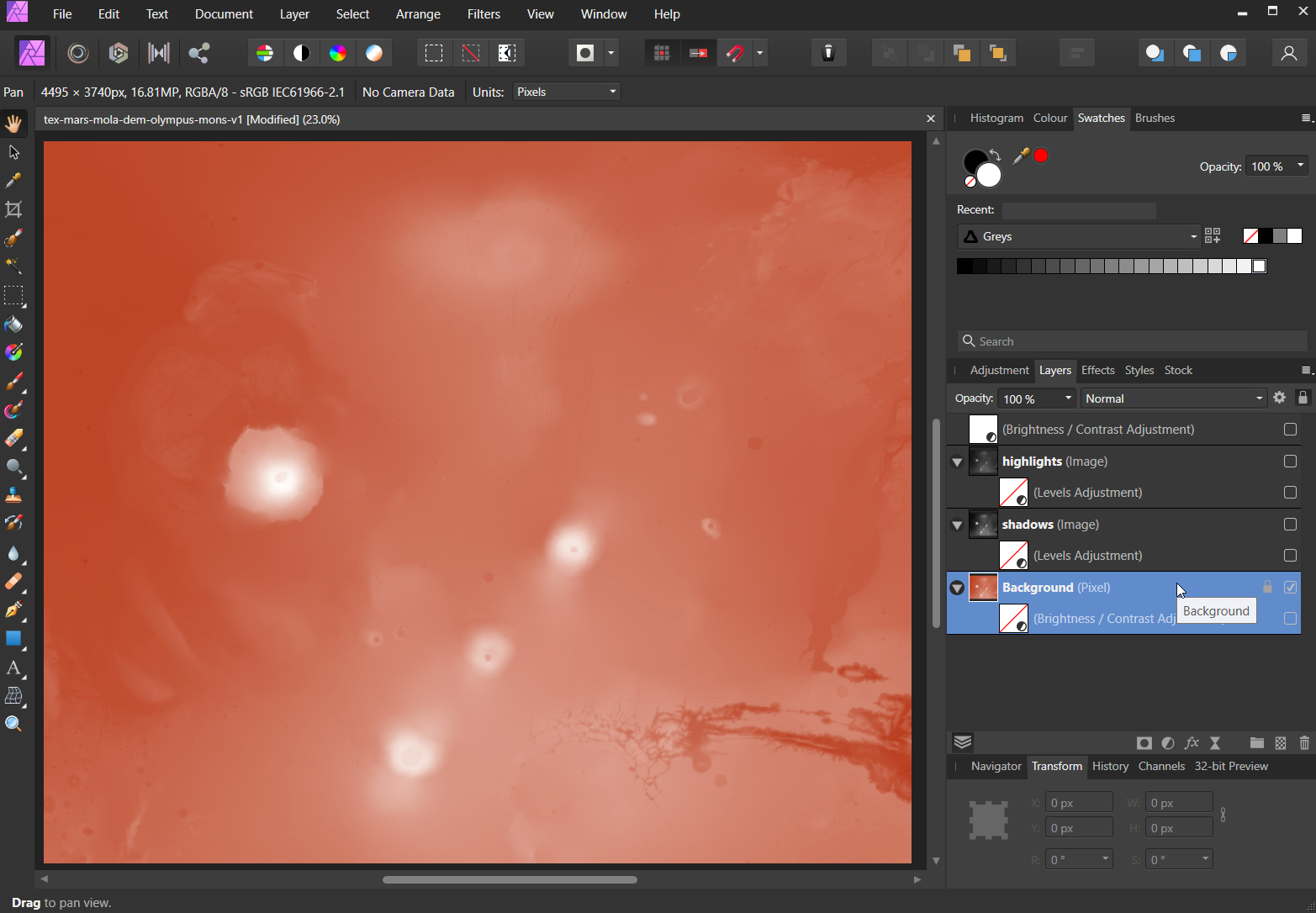
In Affinity Photo, which is an inexpensive but equally powerful alternative to Adobe Photoshop, four layers were created (see animated image below):
- 3 - Brightness/Contrast adjustment layer
- 2 - Highlights: grayscale image, blending mode screen, opacity of 65%, levels adjustment
- 1 - Shadows: grayscale image, blending mode linear burn, levels adjustment
- 0 - Background: coloured image with brightness/contract adjustment
For obvious reasons, the settings for each layer depended on the input image and the style I wanted to achieve, and all layers required some specific fine-tuning, and a little bit of trial and error to get it right.
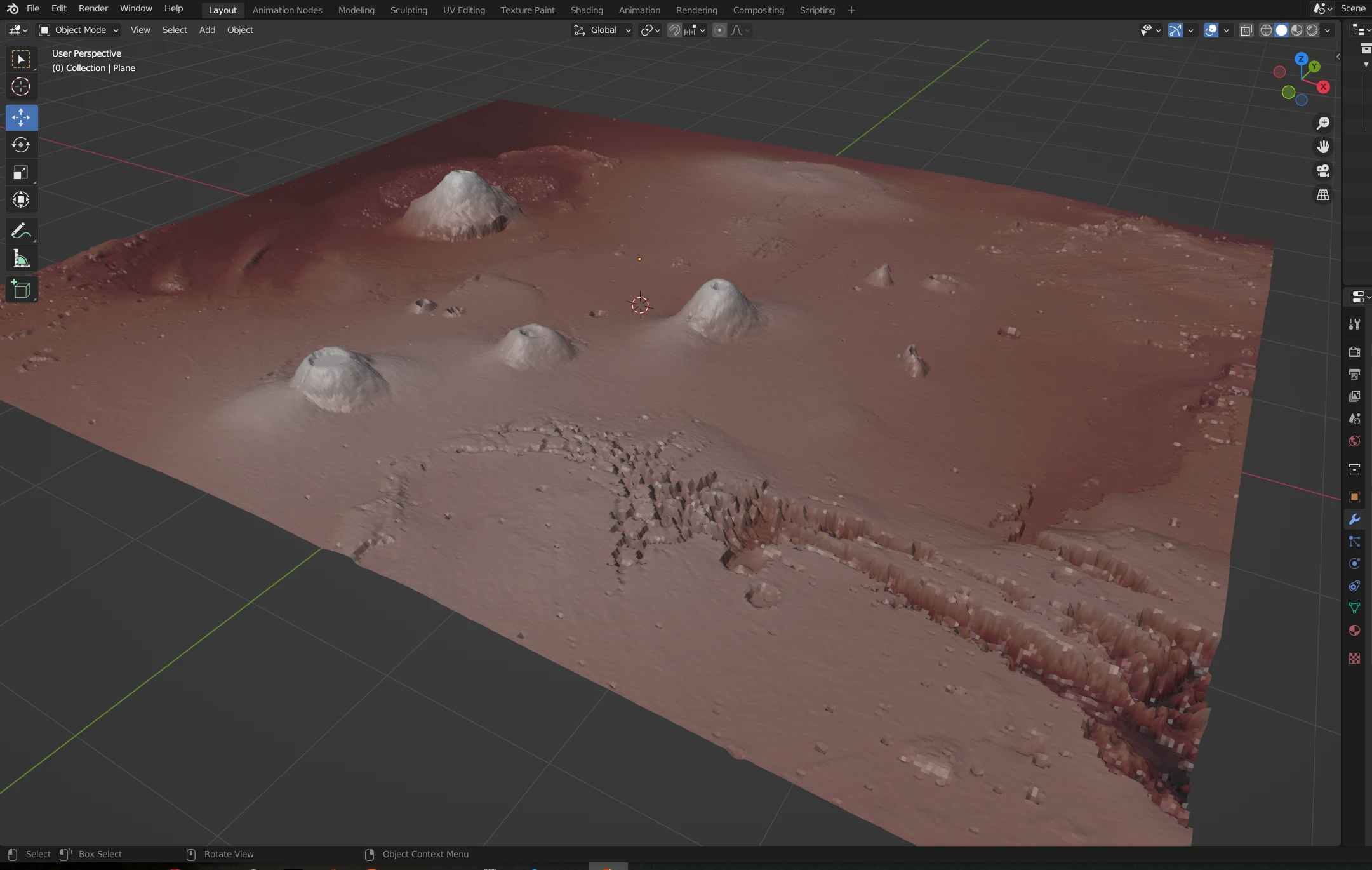
Subsequently, I tried to use Blender3D, which is a fantastic free and open-source 3D modelling software (and so much more!), to further enhance the map. I was not really happy with the result due to a variety of artifacts, and the final map does not contain any rendering from Blender.
What I did, however, was to add a plane to Blenders workspace with the same ratio as the images created above. To this plane, I applied a displacement and a subdivision modifier. The displacement modifier used the greyscale image to displace the plane, while the subdivision modifier increased the resolution of the plane to allow for more detail on the 3D model. Lastly, I added the exported map from Affinity Photo as a texture. You can see the "final" result below. It looks quite alright, and I might continue working on it in the future, to add some sunlight to it to enhance the atmosphere.
This map was inspired by the works of Daniel Huffman (somethingaboutmaps.wordpress.com) and Charles Peppernau (geolographer.xyz); their tutorials and insights about mapping & cartography helped immensely to get started and finish it.
Note: This page plays the first audio recording of the sounds on Mars in the background. Source